near & here.
Press Kit
Last updated: September 3, 2026
At a glance
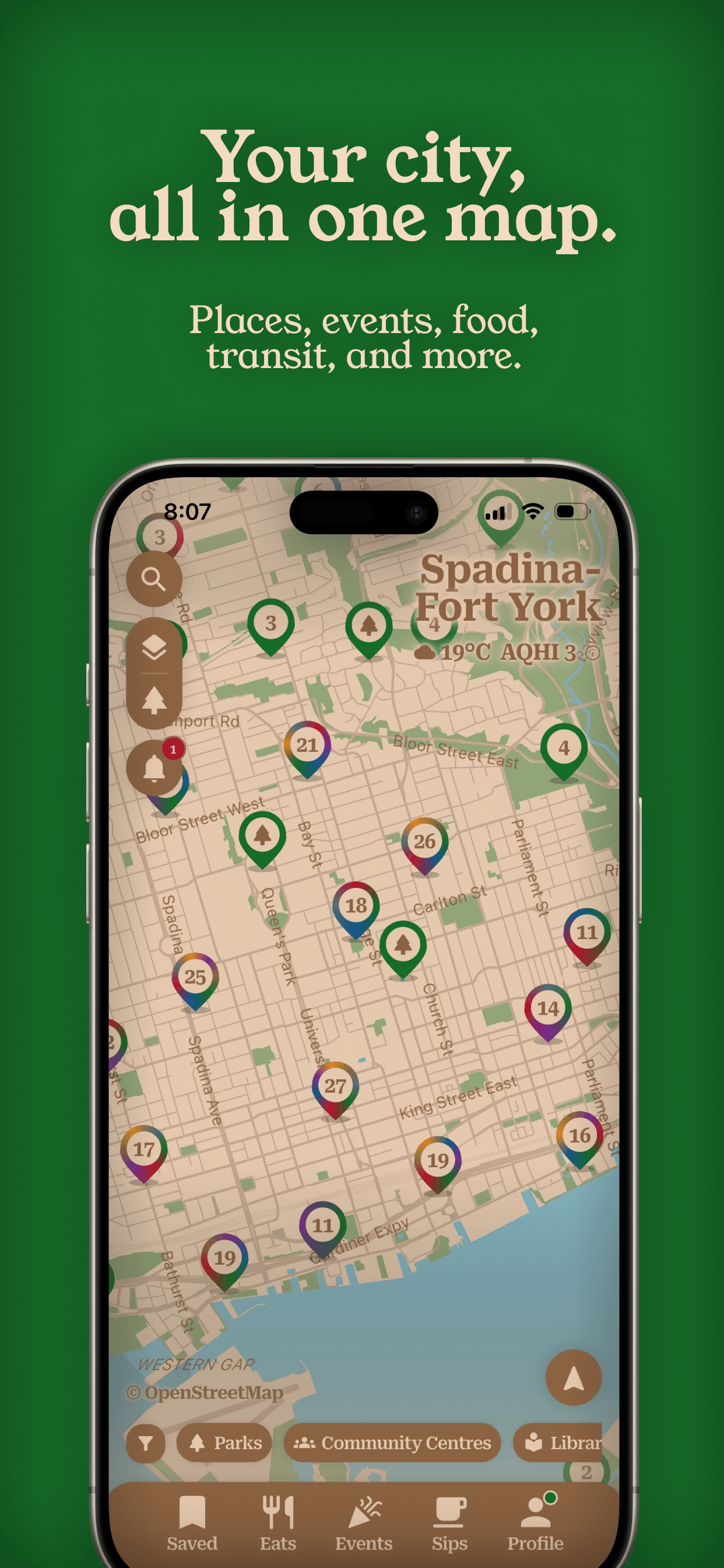
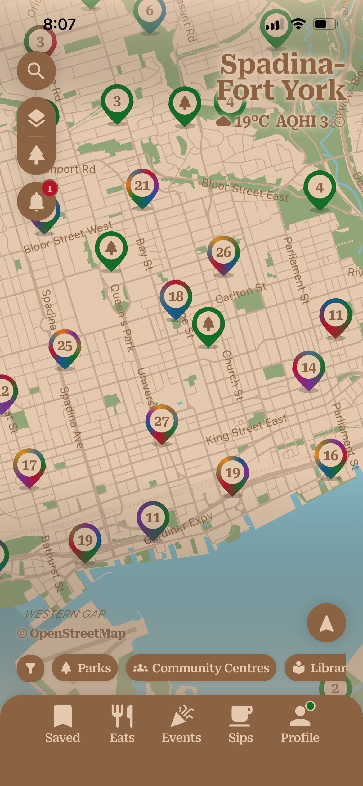
- near & here. puts Toronto's places, transit, events, food and drink, and cycling routes on one map — with directions that adapt to how you're travelling. Free, with no account.
- Made by near & here. society, a Canadian federal not-for-profit. No ads, no paid tiers, no data for sale.
- The work of one person — Vladislav Grigorev — who went deep into civic data after a job interview he didn't pass, and kept going.
- Free on the App Store for iPhone. Released September 2, 2026. Android planned.
- Every listing comes from open government and public data — the City of Toronto, the TTC, Metrolinx, OpenStreetMap, and more.
- Built and hosted in Toronto, on the society's own servers. No Google Maps, no third-party trackers.
- Press contact: Vladislav Grigorev, President & Founder — hi@nearandhere.ca
- Assets: screenshots and logos are linked below, cleared for editorial use.
Fact sheet
Everything here is cleared for publication. Where a value is in brackets, it still needs confirming or filling in.
- App — near & here.
- What it is — one map for the places, events, transit, food, and cycling around you in Toronto, with directions that adapt to how you're getting there
- Maker — near & here. society, a federally incorporated Canadian not-for-profit (under the Canada Not-for-profit Corporations Act), based in Toronto, Ontario. Self-published.
- Mission — to increase awareness of the local resources, services, events, and opportunities available to people in their communities [confirm wording against the articles of incorporation]
- Platform — iOS (iPhone), iOS 15 and later. Android planned
- Released — September 2, 2026
- Current version — 1.0.3 at launch; this line may lag, so check the App Store listing for the version now live
- Price — Free. No ads, no in-app purchases, no subscription, no account.
- Coverage area — Toronto, with expansion to other cities planned
- Languages — English
- App Store category — Navigation (primary), Travel (secondary)
- Age rating — 13+
- Bundle identifier —
com.nearandhere.app - Data sources — City of Toronto Open Data, Toronto Transit Commission, Metrolinx (GO Transit and UP Express), OpenStreetMap, Overture Maps, Environment and Climate Change Canada, Open-Meteo, Ontario 511, Fish ON-Line, Open Charge Map, and others. The full list, with licences, is in the app under Profile → Data & map attributions.
- Technology — a Flutter app over a fully automated data pipeline that keeps every dataset current. Routing (OpenTripPlanner), address search (Photon), and the vector map (Protomaps) are self-hosted on the society's own infrastructure in Toronto. No Google Maps or Places APIs.
- Privacy — no account, no ads, no third-party trackers or analytics SDKs. Optional, anonymous usage analytics only. See the Privacy Policy.
- App Store — apps.apple.com/ca/app/near-here/id6789641423
- Website — nearandhere.ca
- Press contact — Vladislav Grigorev, President & Founder, near & here. society — hi@nearandhere.ca
- Media assets — screenshots (App Store and plain, each with a download-all ZIP), the logo in light and dark cuts, and brand notes are in Screenshots & video and Logos & brand below
The app in one paragraph
This is written to be quoted directly — lift it as-is or trim it.
near & here. is a free app that puts what's around you in Toronto — parks and libraries, TTC and GO times, events, restaurants and bars, cycling routes, fishing spots — on one map, with directions that adapt to how you're travelling. No account, no ads. It's made by near & here. society, a Canadian non-profit, and built entirely on open government data.
The longer description
near & here. began with a job interview. Vladislav Grigorev interviewed for a technical implementation role centred on working with data, didn't get it, and came away wanting to go further into that work than any job would have taken him. The city gave him somewhere to go: Toronto and the Province of Ontario publish an enormous amount of open data — transit feeds, park inventories, event calendars, food-safety inspections — but it sits scattered across dozens of portals, apps, and PDFs. near & here. pulls it into one place, onto one map, kept current by a fully automated data pipeline.
The app covers eight areas — places, events, food and drink, transit, cycling, driving, fishing, and neighbourhoods — and adds walking, cycling, transit, and driving directions with turn-by-turn navigation. The routing is the part that sets it apart: rather than one line from A to B, it plans the trip around the mode you've chosen. Everything is free: no account to create, no advertising, and no analytics beyond an optional, anonymous measure of which features get used.
near & here. society operates the app as a public service. Its servers run in Toronto; the app uses no Google Maps or Places APIs and embeds no third-party tracking or advertising code. The society is a federally incorporated Canadian non-profit and takes no revenue from the app — a condition that several of the data licences it relies on depend on.
What's in it
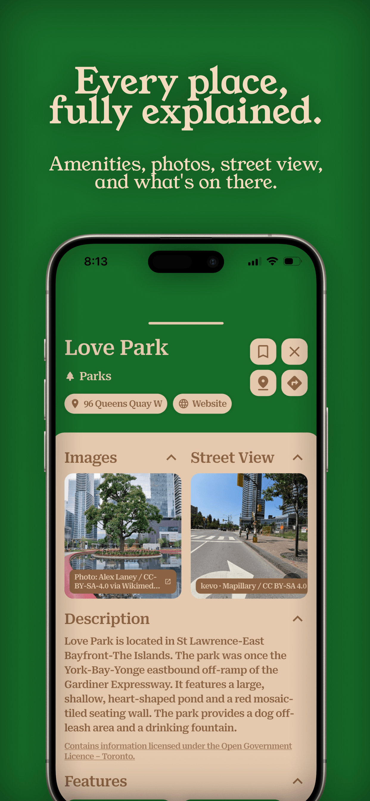
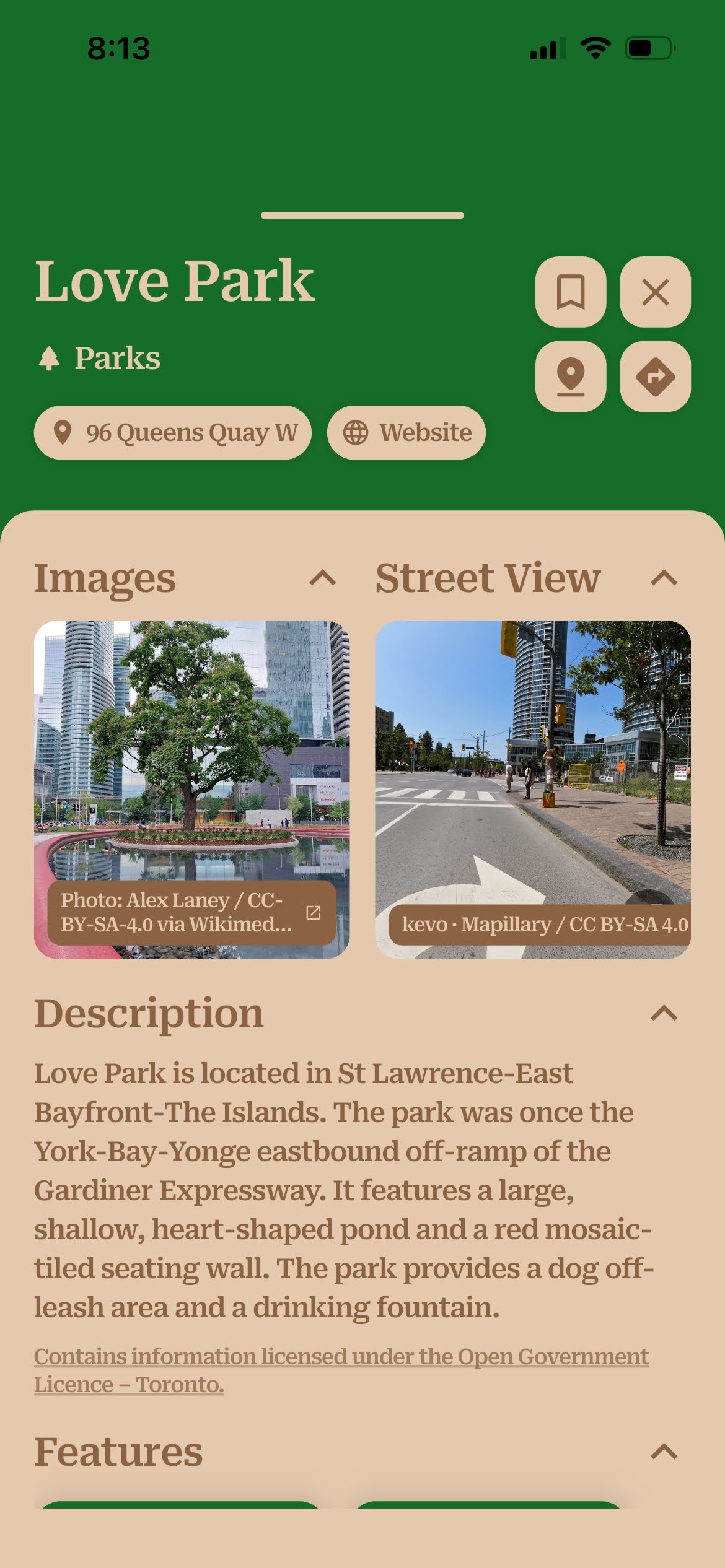
- Places — parks, libraries, community and recreation centres, drinking fountains, washrooms, public Wi-Fi, and places of worship
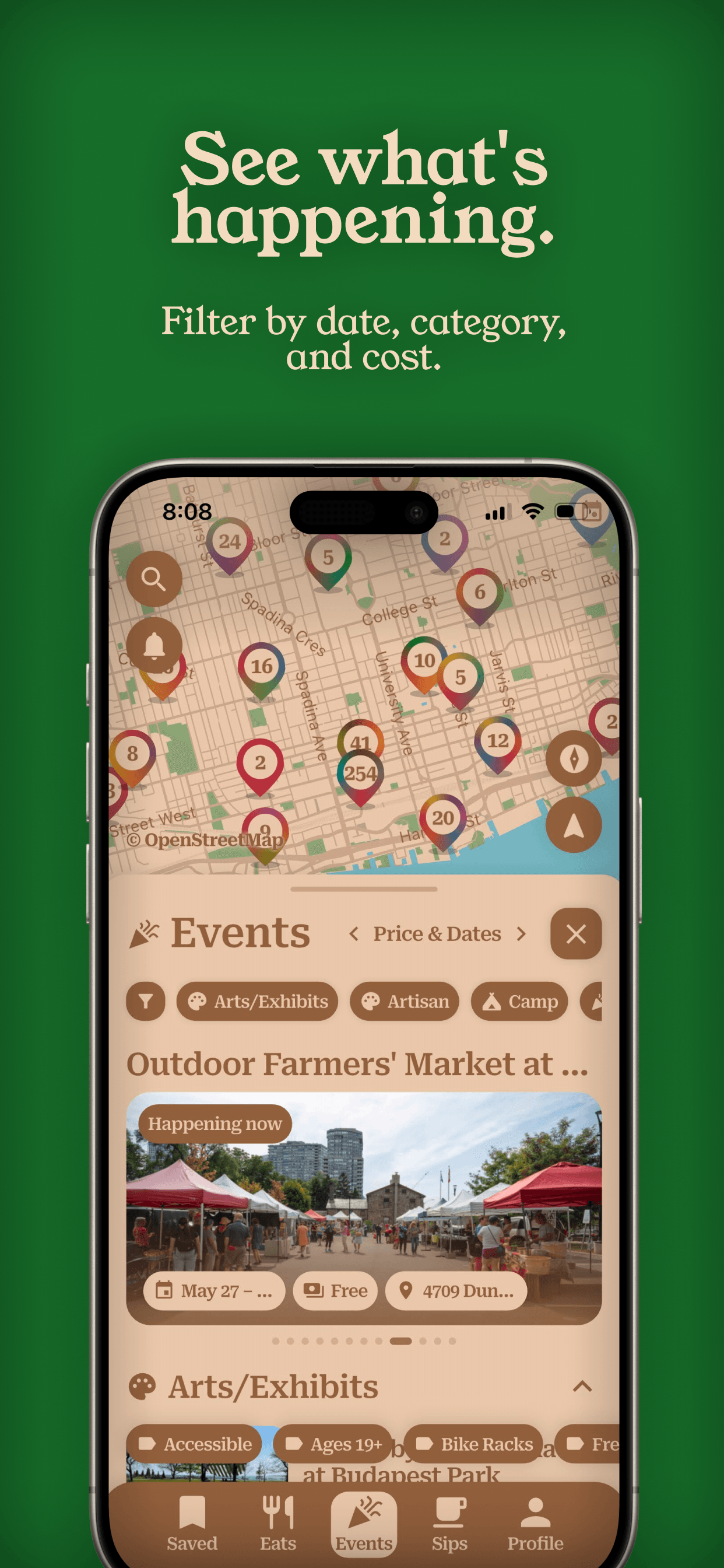
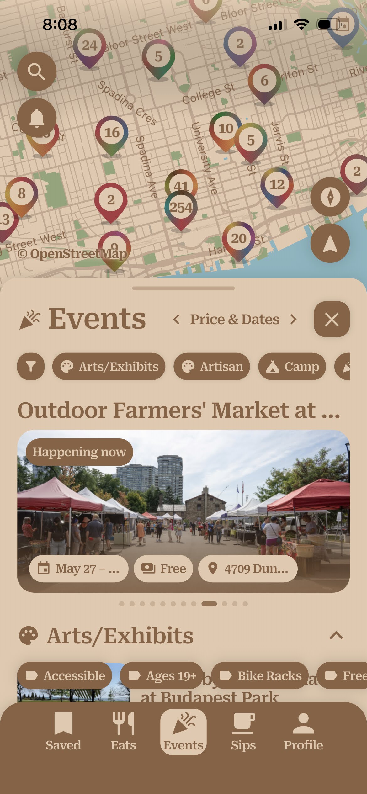
- Events — thousands of upcoming festivals, exhibits, markets, and library and recreation programs, filterable by date, category, and features like "free" or "accessible"
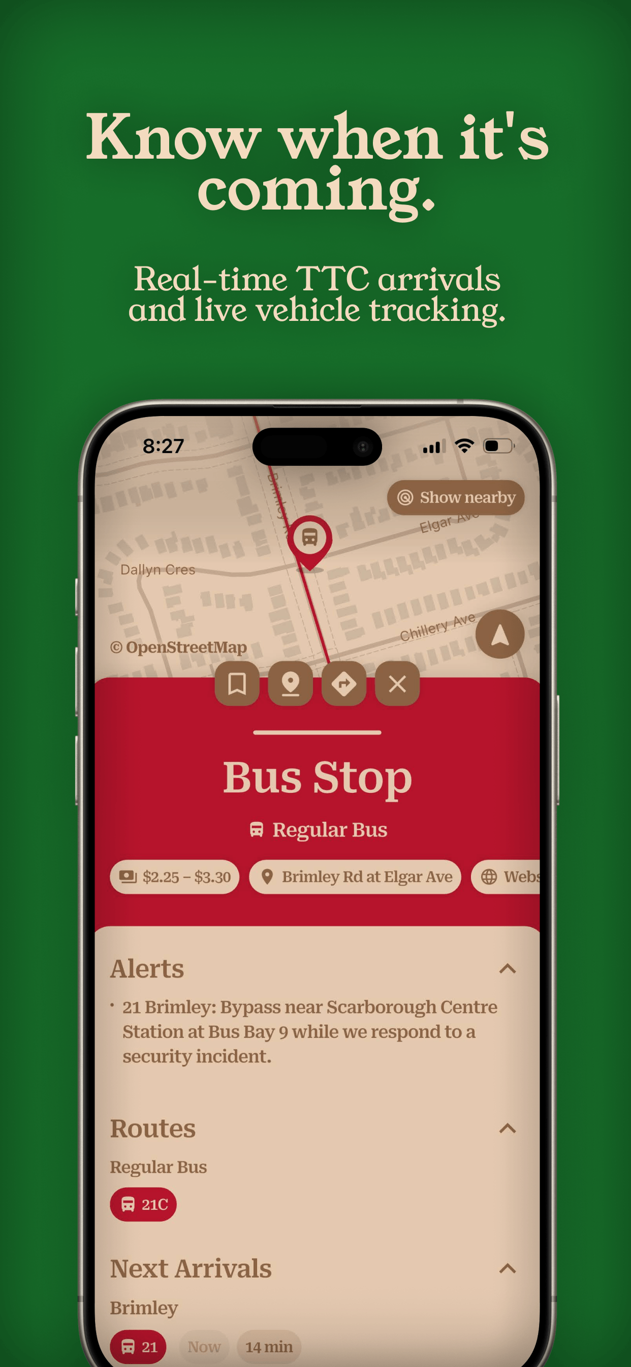
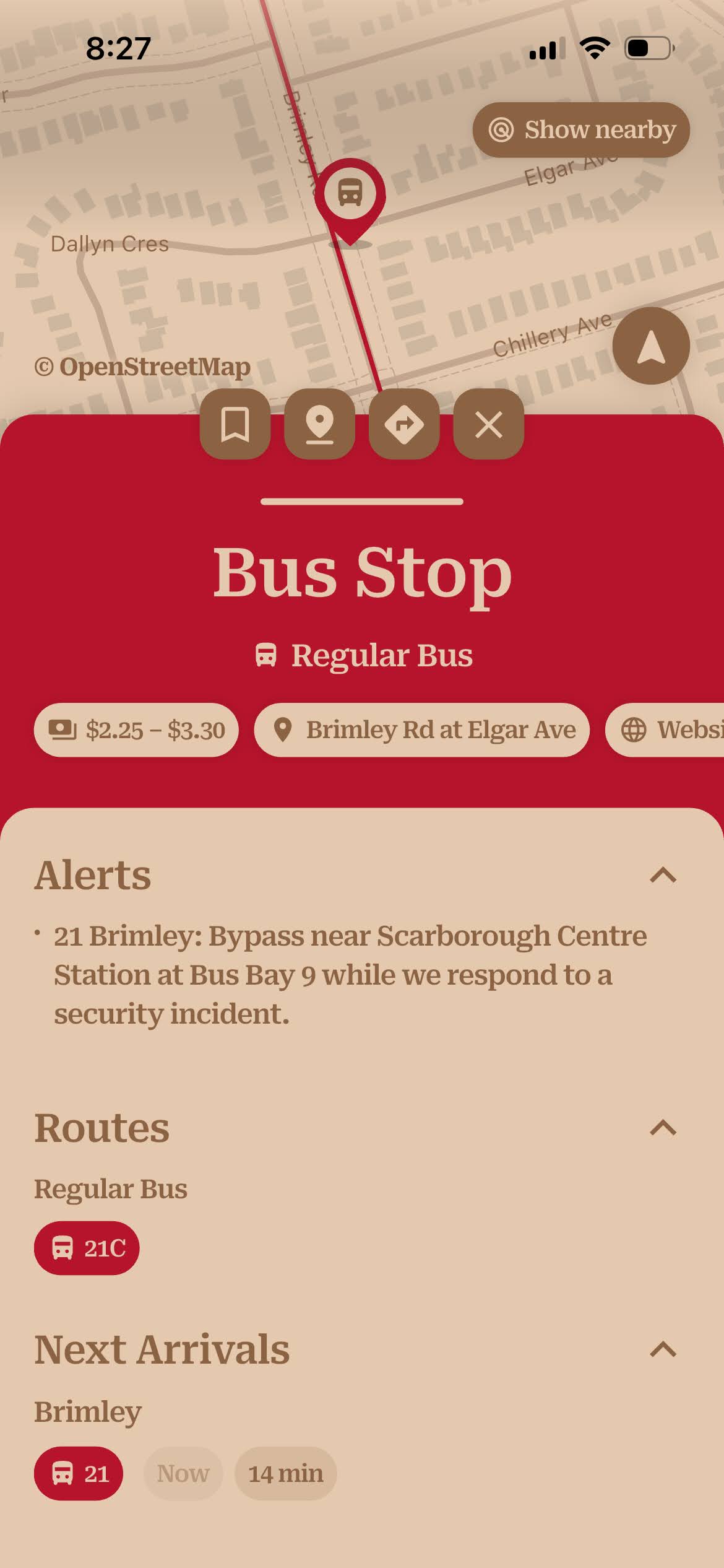
- Transit — real-time TTC arrivals and vehicle positions, service alerts, GO Transit and UP Express, live Bike Share availability, and PRESTO retailers
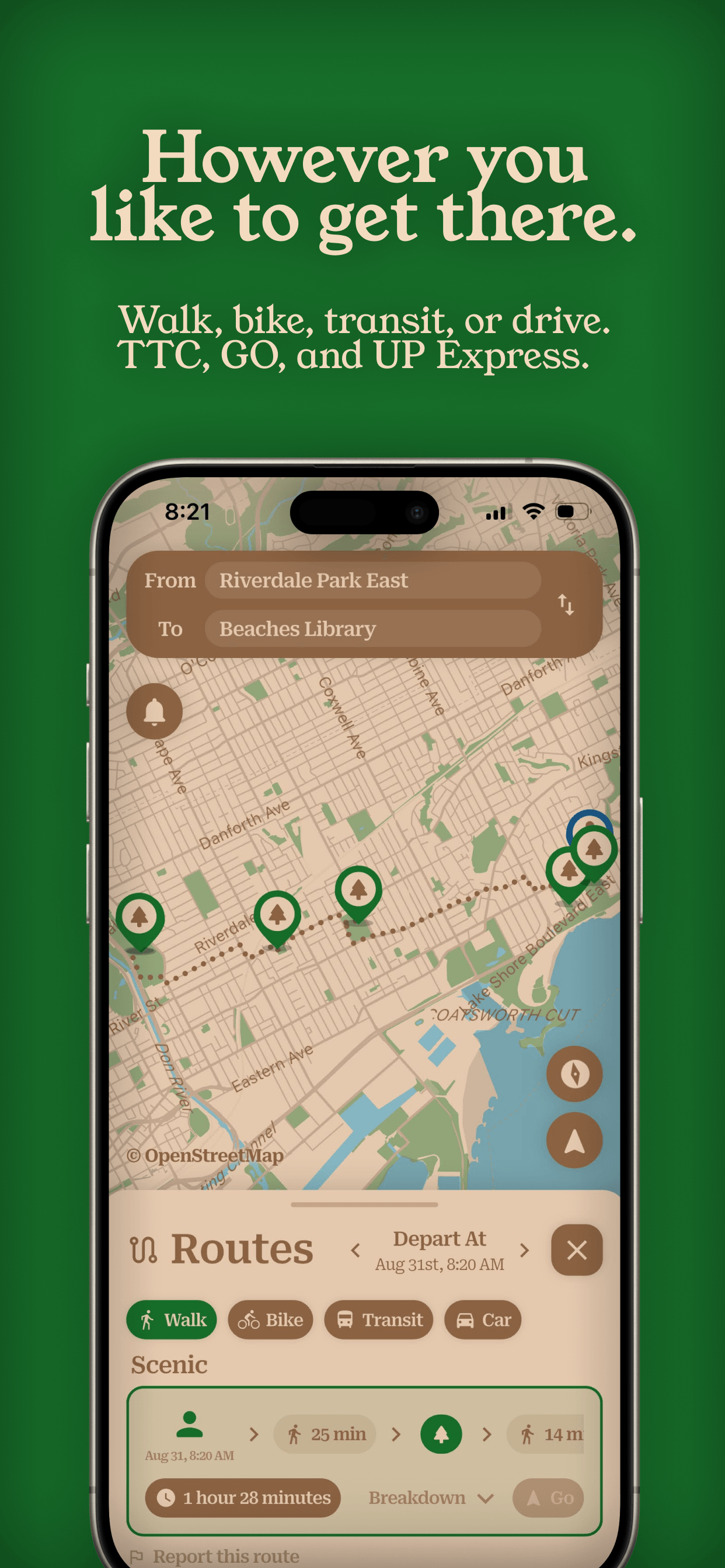
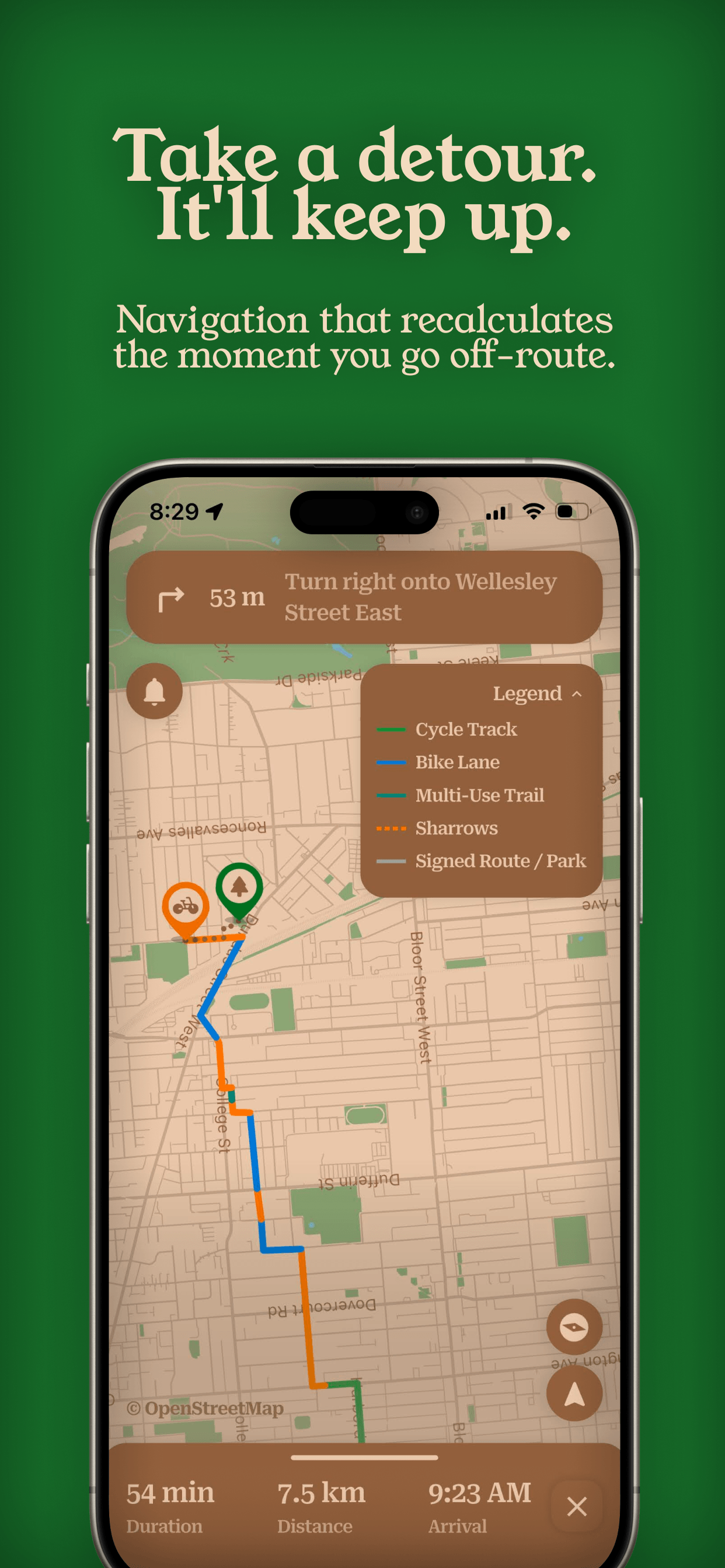
- Getting around — walking, cycling, transit, and driving directions with turn-by-turn navigation that recalculates when you leave the route; the routing adapts to the mode (see below)
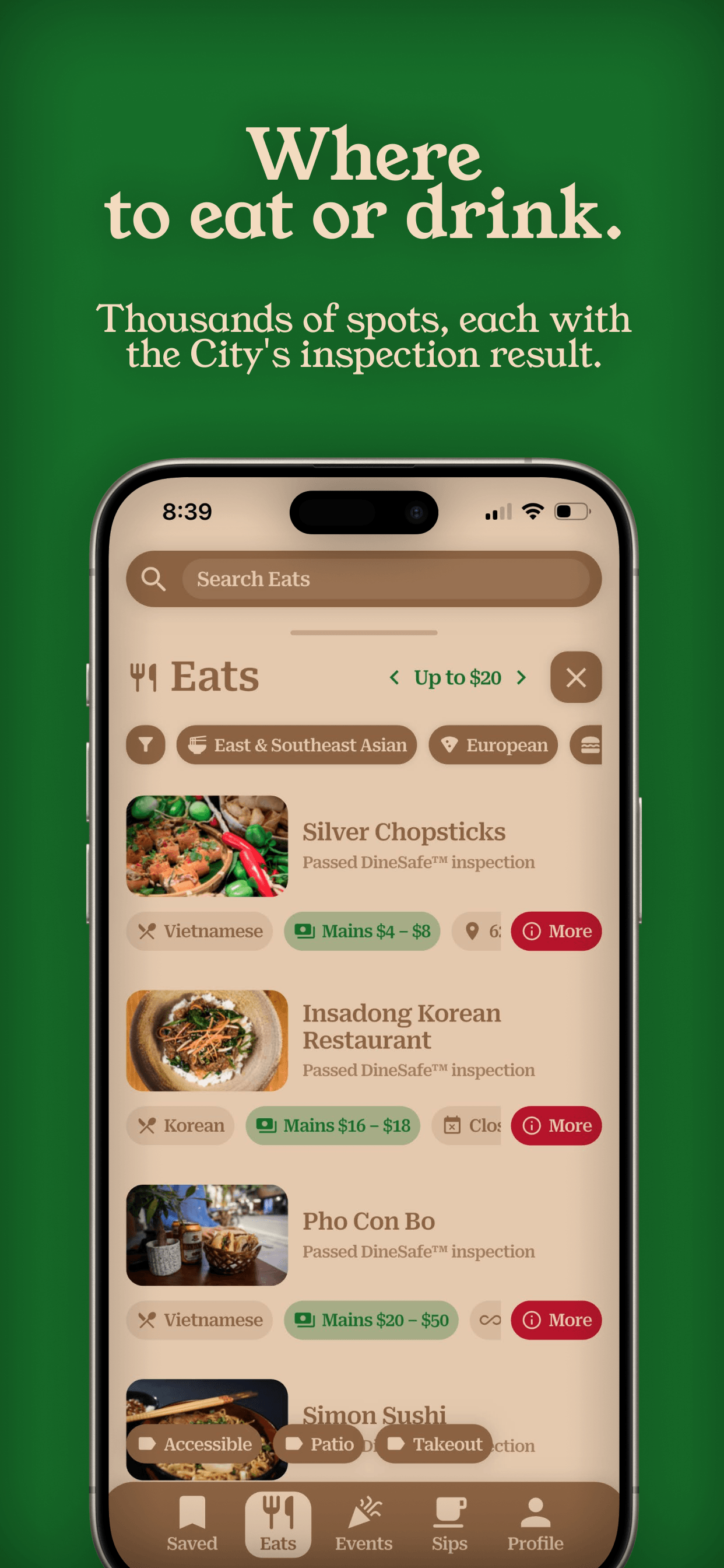
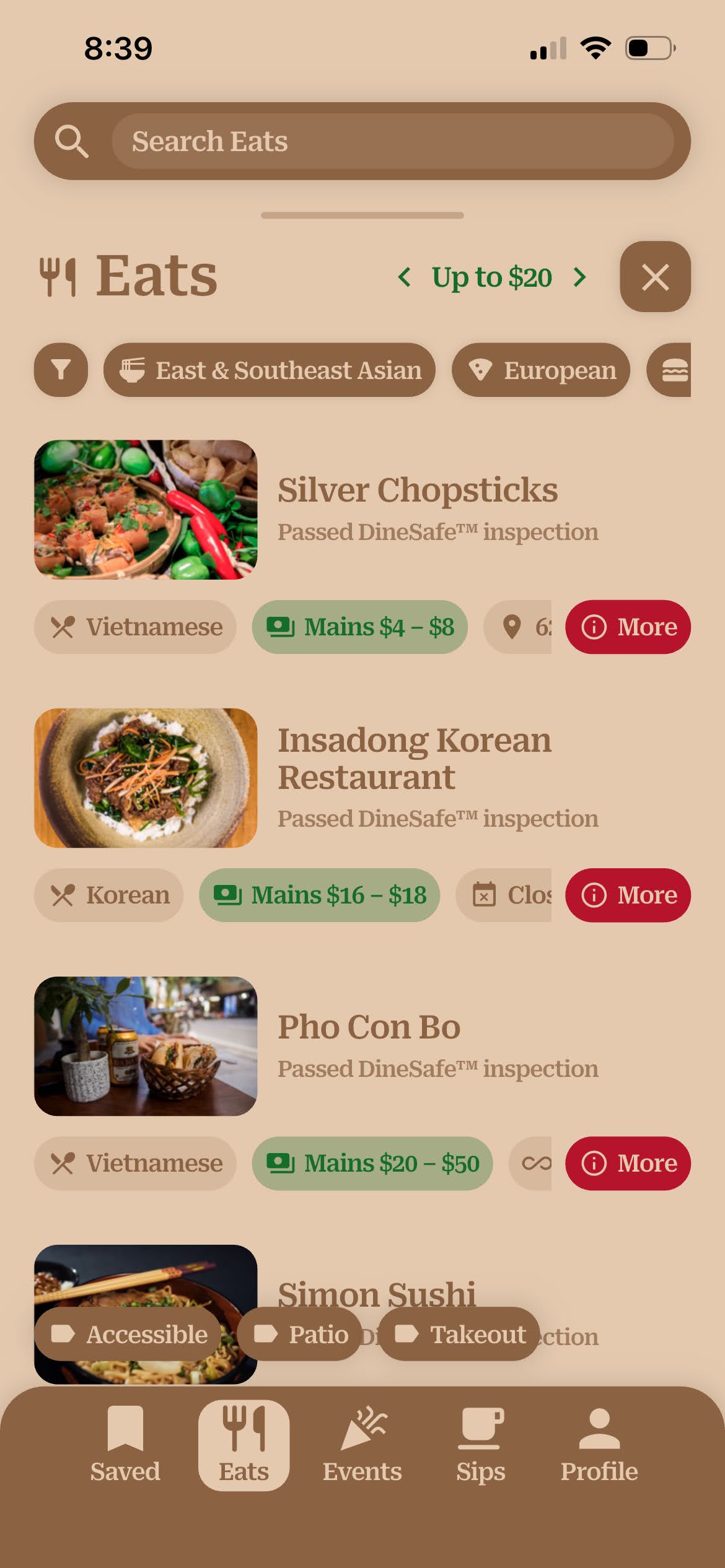
- Food & drink — restaurants, cafés, and bars, each shown with the City's DineSafe inspection result and how it was matched
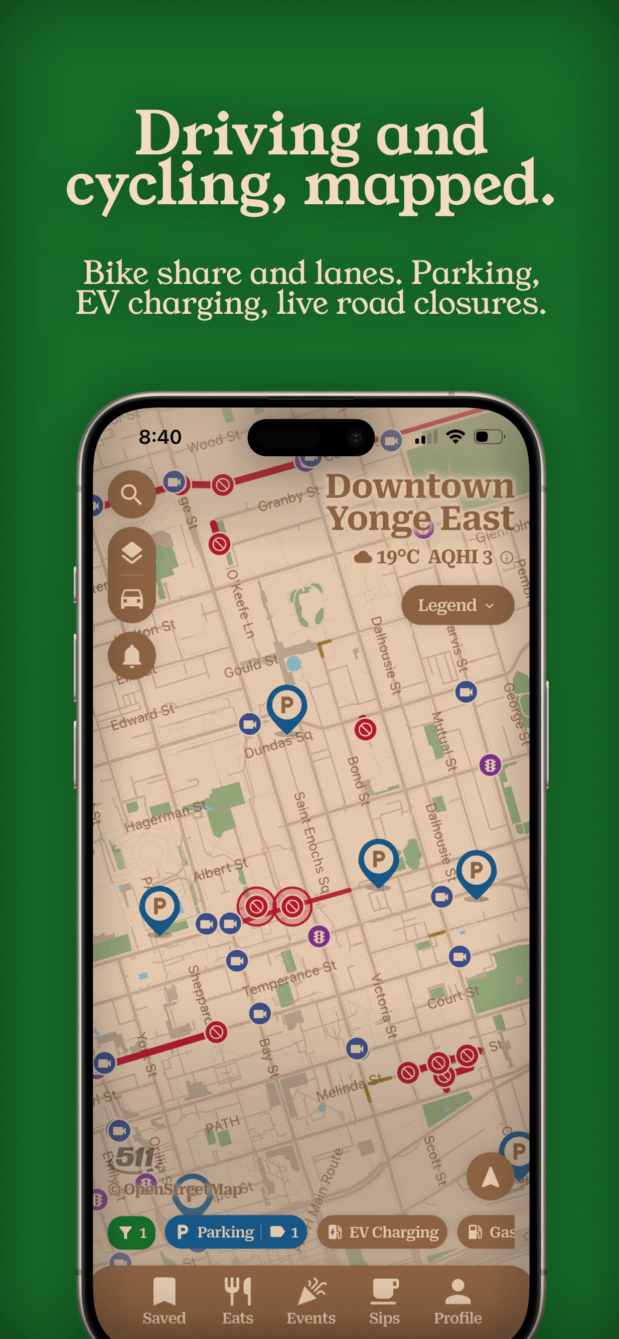
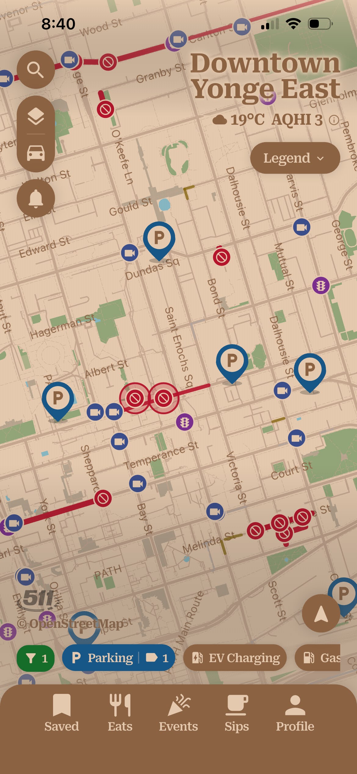
- Driving — EV charging, gas prices, Green P and street parking, road closures, and red-light and traffic cameras
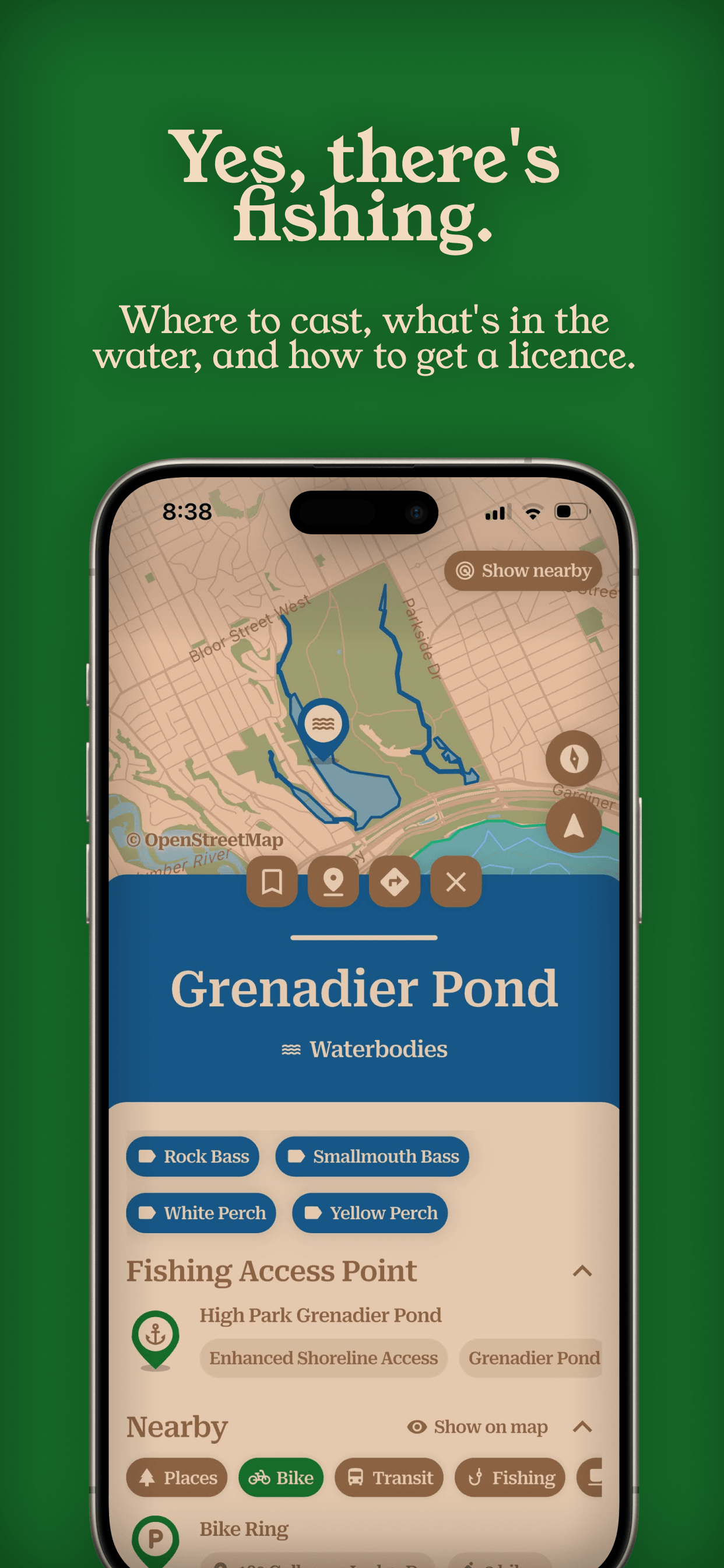
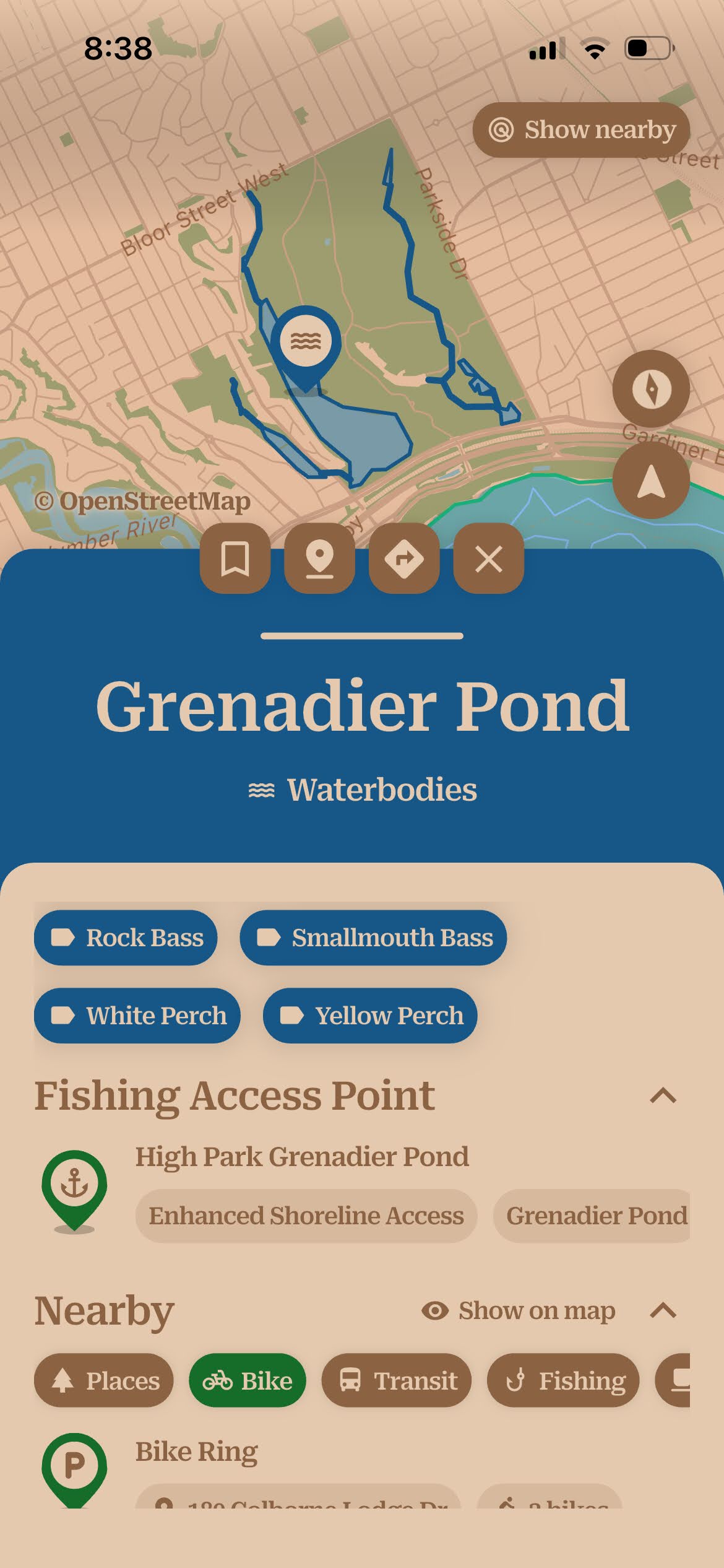
- Fishing — waterbodies and their species, public access points, lake-depth data, and licence issuers
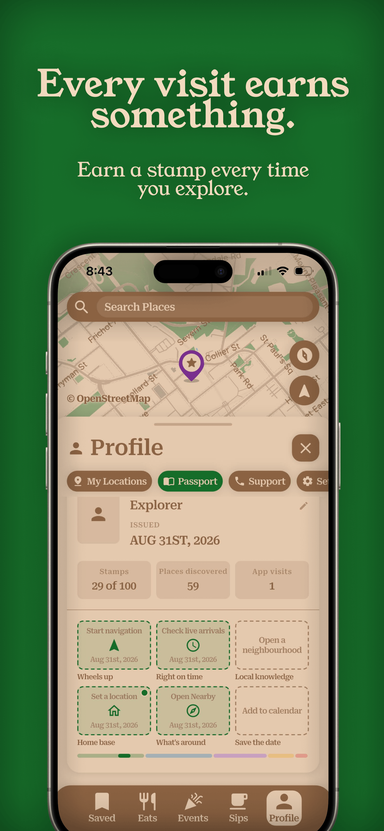
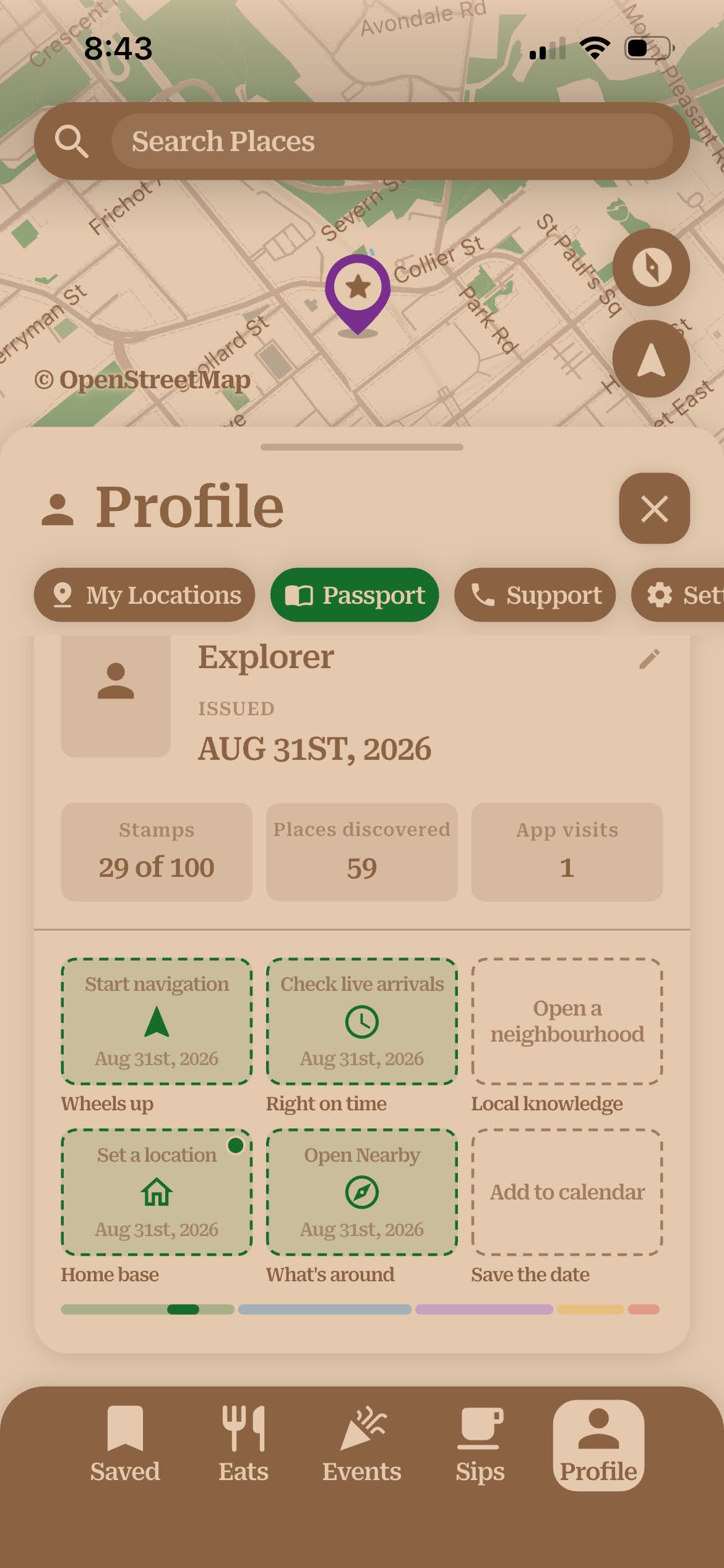
- Passport — a private, on-device record of the places you have explored, with stamps for milestones
- Also — current weather and the Air Quality Health Index inline; street-level imagery from Mapillary; neighbourhood-by-neighbourhood browsing
Directions that adapt to the mode
Most apps draw one line between two points and let you switch the transport icon. near & here. plans the trip differently for each way of getting there:
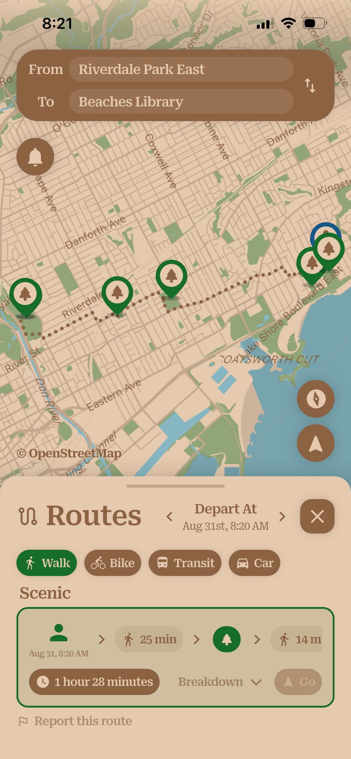
- Walking — the direct route, or a scenic one routed through parks and green space.
- Bike Share — built around live dock data: it starts you at a station that has a bike free right now, ends at one near your destination with open docks to return to, and covers the short walk at each end.
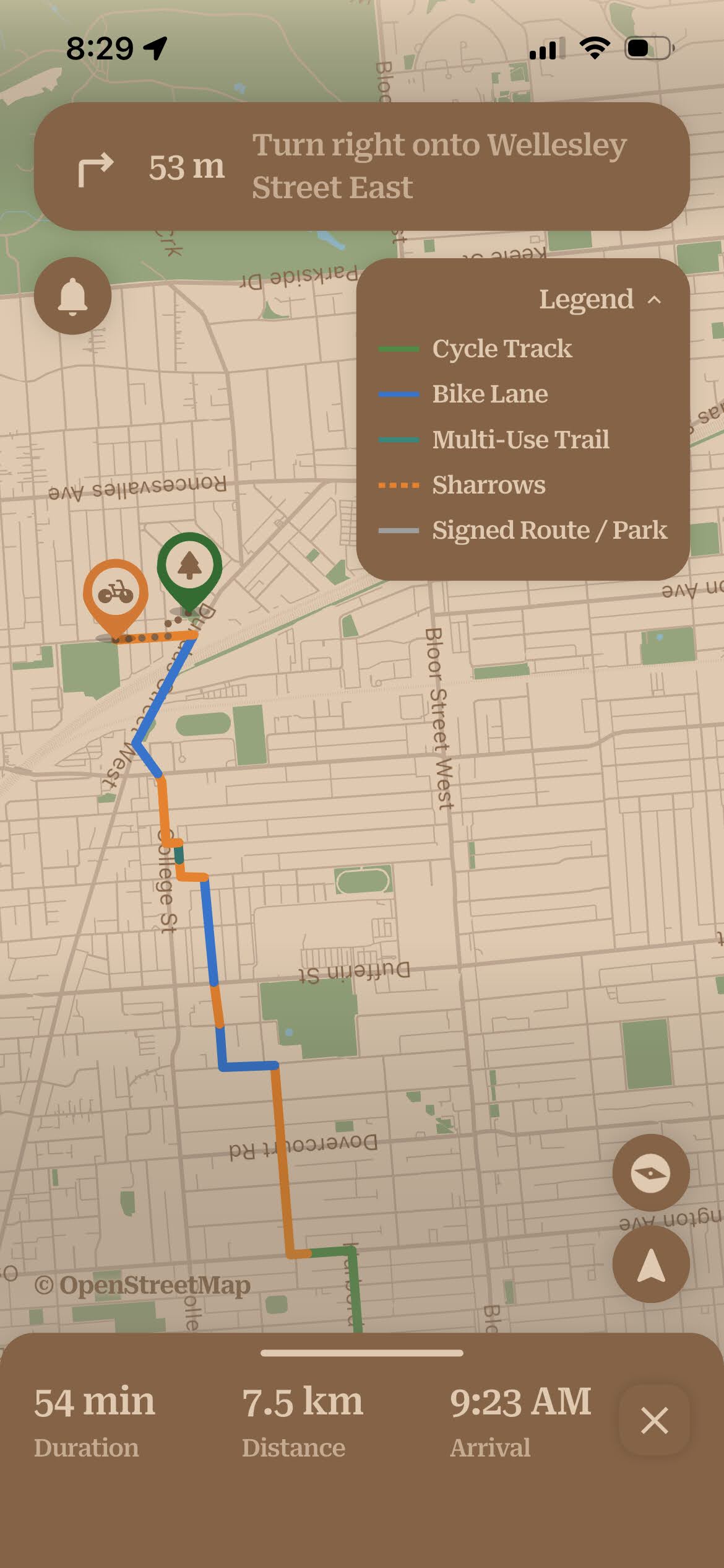
- Your own bike — follows bike lanes and trails and ends at the closest place to lock up, with a legend for the infrastructure type (cycle track, bike lane, multi-use trail, sharrows).
- Transit — keep it to the TTC, or widen it to take in GO Transit and UP Express.
- Driving — go point to point, or have it route to the nearest parking to your destination and walk you in from there.
Story angles
Different framings for different desks. Each is a few sentences a reporter can build on.
The whole city on one map
Most people juggle a handful of apps to get around a city — one for transit, one for events, a search engine for everything else. near & here. is an attempt to put all of it in one view: what's nearby, what's on, and how to get there, without an account or an ad in sight.
Built after a job interview that didn't work out
Vladislav Grigorev interviewed for a Technical Implementation Analyst role built around working with data and didn't get it — but the process convinced him he wanted to go deeper into civic data than any job would let him. near & here. is what came of that: a data-heavy app with a fully automated pipeline behind it, built solo and run through a non-profit he incorporated for the purpose. He credits his earlier work in game development — on Billy's Cookies, with Dough Dough Digital Inc. — for how quickly it came together.
Built entirely on public data
Every pin in near & here. comes from open government or public-sector data — the City of Toronto, the TTC, Metrolinx, the Province of Ontario, Environment and Climate Change Canada, OpenStreetMap. An automated pipeline pulls, cleans, and reconciles it on a schedule; the routing engine, the address search, and the map itself are self-hosted in Toronto rather than rented from Google. It is a working example of what the city's open-data program makes possible.
Privacy-respecting, from a non-profit
near & here. has no account, no ads, and no third-party trackers or analytics SDKs — no Google Analytics, no Firebase, no advertising identifier. Usage analytics are opt-in and anonymous, and searches for sensitive services are stripped out before any measurement happens. The app is run by a registered non-profit with no revenue model.
Directions that fit how you're travelling
The routing doesn't just draw a line and let you pick a vehicle. A walk can be sent through green space instead of down the fastest street; a Bike Share trip is planned around docks that have a bike free now and room to return one at the other end; a transit trip can take in GO and UP Express or stay on the TTC; a drive can end at the nearest parking and walk you the rest of the way. Full detail under Directions that adapt to the mode.
Screenshots & video
Two sets are available — the App Store images with the headline set in the frame, and plain captures of the interface on its own. Every image links to its own full-resolution file.
App Store screenshots
Download all ten (ZIP, 9 MB) · full resolution 1242 × 2688 PNG.
Plain captures
The same ten screens without the marketing frame — just the interface. Download all ten (ZIP, 2 MB) · 1170 × 2532.
Demo video: [YouTube or Vimeo link] · Broadcast b-roll (60–90 seconds, no music or captions, for editing into a segment): [link]
Usage. near & here.'s own screenshots, interface, logo, and video may be used in editorial coverage with credit to "near & here." Photographs shown inside the app — of events, venues, and streets — belong to their original photographers or sources, are credited on each image, and are not cleared for reuse from this page.
Logos & brand
The wordmark sets "near & here." over a downward map pin whose counter holds the ampersand. Use the cut made for your background.






Colours — primary green #166D29 · cream #E4C9AE · brown #6B4A32 · marketing-site green #206F50
Typeface — Roboto Serif (Young Serif for display on the marketing site)
The name — written as "near & here." — lowercase, with the ampersand and the trailing period. Please don't alter the logo, recolour it, or use the near & here. name or mark in a way that implies a partnership or endorsement that doesn't exist.
Attributions — if you reproduce a screenshot that shows in-app content, the data-source credits it displays are licence conditions and should stay legible.
Selected coverage
Coverage will be linked here as it appears.
About near & here. society
near & here. society is a not-for-profit corporation incorporated federally in April 2026 under the Canada Not-for-profit Corporations Act, based in Toronto, Ontario. It builds and operates the near & here. app as a free public service. There is no advertising, no paid tier, and no outside funding, and the society takes no revenue from the app.
Vladislav Grigorev is the President and founder of near & here. society, and built the app himself — the interface, the backend, the automated data pipeline, and the servers it runs on.
He came to civic data through a job interview he didn't pass: a Technical Implementation Analyst role, centred on working with data, that left him wanting to go much further into it than the job itself would have. Building near & here. is where that went — and along the way the aim shifted from picking up the skills to making something people could actually use to find their way around the place they live. His earlier work was in game development, on Billy's Cookies with Dough Dough Digital Inc., which he credits for how fast a solo build came together. He is based in Toronto; his own account of how the app came about is on LinkedIn. A headshot is available on request.
Contact & press enquiries
near & here. society
Toronto, Ontario, Canada
Press & general enquiries: Vladislav Grigorev, President & Founder
hi@nearandhere.ca
We read every message. If you're working to a deadline, say so in the subject line and we'll do our best to move quickly. We're happy to arrange a walkthrough, an interview, or an on-camera demo.
See also the Privacy Policy and Terms of Use.